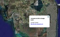
ArcDex Tutorial - Display Your ArcMap Data in Google Earth
Looking for a free, lightweight ArcMap extention to plot your ArcMap data in Google Earth? This tutorial demonstrates a quick project showing recent tornados in Florida, and just might be your answer.
Download the final product here to skip the tutorial and see the data in GE.
Tuesday, April 04, 2006
Posted by Ken H. at 2:49 PM
Subscribe to:
Post Comments (Atom)
1 comments:
this is a VERY COOL TOOL, thanks so much for posting it on the google earth community board. we're on a deadline here and our gis server is down...this helped keep the designers in my office working. nyc parks greenstreets thanks you!
Post a Comment