Trimble GeoXT Note
Well today I dusted off my trusty 'ole Trimble GeoXT. Unfortunatly, it's been mothballed since December. Just didn't have any projects for it.
Well when I fired it up it went into some kind of mandatory 15 minute charge up mode. After that, I tried to start up ArcPad 7. Nothing. Couldn't find it anywhere in the system. Well, it took a full re-installation and sync to get back up and running.
Not sure what the technical aspects are of this, but I'll never let this thing get that run down again. Now I'm headed outside (finally - it's 75F and breezy.)
Monday, August 21, 2006
Wednesday, August 16, 2006
After geospatial blogs were totally overlooked at the ESRI 2006 Users Conference, I was excited to see that there would be an article about such blogs in the Jul-Sep 2006 edition of ArcUser magazine. But, in the end, I was un-fullfilled (once again :) ).
I think the main reason for this disappointment in the article was the discussion of the extreme basics of the technology that bring us blogs, and not focusing on content. On page 30 we are talking about object model diagrams and cursors for arcobjects, then we move along the line a couple of pages to the definition of a "podcast???" Consider your audience here. And good luck finding something on PubSub - use Google Blogs or Technorati search engines to find something useful.
Lastly, the authors only plug their own website and like one or two more (3 of which are aggregators and not blogs). Not that the following blogs need any plugs, but here are a few that I thought would be no brainers to talk about or maybe even get interviews with:

Tuesday, August 15, 2006
ESRI Tools At Different License Levels
One thing that drives me crazy is forgetting that I have ArcInfo and then distributing models to ArcView users who cannot use them. I really wish there was some type of color code on ArcToolbox that would remind me that its a ArcInfo only tool. Well until that happens, I've been using this file from the Online Help.
You may also find it helpful.
Monday, August 14, 2006

Where 2.0 Conference Presentation Files
The presentation files (PPT) are now up at the Oreilly Where 2.0 conference held back in June 2006. There are alot of good topics that I am saving for review, after I try out some of the new tips and tricks learned at the recent ESRI UC. Can't absorb too much in such a small time frame!
Saturday, August 12, 2006
It's a Wrap - 2006 UC
Well the curtains have come down once again on another ESRI users conference. Overall, I think it went great, but the format and topics are getting a little stale. Kudos to the San Diego Airport TSA staff - when we got to the airport at 9AM there was NO ONE in line for security! I am sure we all were thinking about the world events as we flew out on Friday. I felt very safe without being inconvenienced.
There are a couple of wrap up items out there you might want to check out:
- James Fee's reflections on the conference
- A new Video Blog emerged called GIS Nation - <
> - What's new in ArcGIS 9.2
- ArcGIS Explorer movie demo
- ESRI Touchtable Demo
- Be sure to register for a 9.2 demo in your state here
Wednesday, August 09, 2006
2006 UC Photos....
This photo is of the 1/4 scale elevation map of British Columbia. Glenn over at AnyGeo has a good write up about it. Seeing the natural curvature of the earth on this display makes it a must!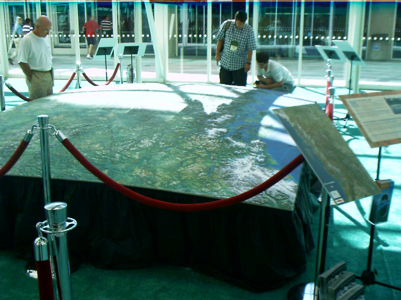

Tuesday, August 08, 2006
Animation Tools in ArcGIS 9.2
Live from the UC conference here in San Diego, I just watched a great demonstration using a new tool called Animation. The demo just showed population change over time in the northeast portion of the United States. Now instead of having to print out maps for each decade, the symbology changes as the values change. The animation can then be exported out to mov or avi's.
I can imagine that over the course of a year, this will be a tool that is greatly utilized for Planning Commission meetings, and the such. I went over to the ArcGIS Explorer display to see if they could take in Animation features into Explorer, but the answer was no.

Tuesday, July 25, 2006
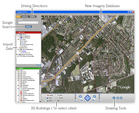
Google Earth Effect
Today the All Points Blog featured a column in the Belfast Telegraph talking about satellite photos of a Pakistani nuclear reactor under construction. But it wasn't disclosed by some secret defense analyst, the images were found on Google Earth.
APB notes that the article makes mention of the "Google Earth Effect" popping up in several places around the web. I think that this so-called 'effect' is just viewers seeking consumer level aerial photography, and in a hurry. There will come a time when images used in the media will be near-real time, to include before and after scenes like those in the Katrina analysis.
But this GE Effect will not lead more users to embracing commercial GIS. I am sure that people don't realize that GE is the MS Paint of the GIS world.
And I don't know why the media isn't ready to start doing real time geostatistical analysis on the air. Here in Michigan, they proposed a making it a rule making it illegal for a convicted sexual offender to live within a 1000 foot buffer around a school. Sounds great on its face. But when I threw a quick 1000' buffer on a map around schools in my area, I realized it only affected about 10 homes around the school: and a rule like that would be theoretically ineffective. But I guess that wouldn't be a popular position to take.
Friday, July 21, 2006
US Panoramic Maps from the 1800's
The folks over at b12 Partners led me to a huge resource of historic panoramic maps from the Library of Congress. These 1,726 bird eye view maps (oblique angle) are available here. Many are availble for download in JPEG2000 or MrSid.
These maps really make me miss the old days of truely artistic cartography.
TAGS: maps \ GIS \ History
Thursday, July 20, 2006
Boston's Big Dig a Big Headache for Online Maps
Wow! This has to be the first piece of 'bad' press against the online mapping community. :) Although it really isn't a bad thing, I don't think anyone expects 'live' maps (yet). But the Boston Globe is documenting TeleAtlas' frustrations in keeping up with the constant ramp closures and reconfigurations.The Big Dig has long been a hassle for the online mapping world, with so many shifts and openings that the mappers can't keep up. Two years after the main Interstate 93 tunnels were fully open, online maps were having a hard time catching up. They still are.
TeleAtlas is also not releasing some data, but consumers won't use it quickly enough. So is the data coming in too fast? cool.
I believe we will probably not put the most recent data in, because 98 percent of customers will not be consuming it on time," said Al Cooley, senior director of global product marketing at Tele Atlas.
GPS \ Google Maps \ GIS \ News
GeoTagThings.com & Introducing GeoLibro.
First, I would like to introduce a very informative blog that I have been reading the past couple of days: Geolibro. Geolibro is published by the Purdue University GIS Librarian. I am finding that the best info is starting to come out of these academic blogs, as opposed to some commercial resources. I mean wouldn't it be great to just be able to research GIS all day!
Geolibro has a great write up on a new website called Geotagthings.com. He writes:
Am I slow? I just heard about Geotagthings.com, and it appears to be yet another boon to those interested in writing their web content to geospace. I guess we could call it geobookmarking, where we (users) organize our world of web content by how it’s organized across the planet. The concept isn’t wild here, but I’ve played with this tool for about ten minutes (What? I get excited.) and it is very easy to tag your web content. You save a bookmarklet to (probably) your bookmark bar and whenever you come across a web page that you want to tie to a place, you just click that bookmarklet. You’re then taken to the geotagthings site, where you verify the location, add an optional note, then complete the tagging process and return to the original website.
ArcGIS 9.1 Service Pack 2
Just a general announcement in case you haven't heard, but SP 2 is out for ArcGIS 9.1. Direct Link.
Monday, July 17, 2006
Science On a Sphere (r)
From the NY Times and Computers, Society, and Nature blog, comes a story about NOAA's Science On a Sphere project.
"Science on a Sphere takes flat, two-dimensional images and data taken from spherical objects like planets and moons, and synchronizes and blends them into animated presentations. Most of the almost 100 presentations created so far are silent displays meant to illustrate lectures."
What's more exciting is the authors immediate thought that GIS data could be overlayed on these spheres:
"The specs state that the software accepts most graphics formats, but these are static .gifs, .jpegs, etc. Integrating the system with a GIS platform would allow the user to add/modify layers and create annotations on the fly (think of a sketch map, except rotating and 6 feet in diameter). I’ve simplified some of the details, but it’s doable."
Check out these simulations at the NOAA Site.
I've decided I want ArcGIS Explorer to have a hologram function now :)
Friday, July 14, 2006
ArcGIS on Mac OS X
Mac users - check out this post from c. spanring who is running ArcGIS desktop on his Mac.
What did he do?
Well, first I had to decide which virtualization software I want to use. Basically I had a closer look at Apple’s Boot Camp and Parallels Desktop. Whereas Boot Camp doesn’t count as virtualization tool. It just enables booting and running Windows on any Intel Mac. That was mainly the reason why I didn’t go with Boot Camp. Every time you need Windows-only software you’ll have to restart your machine. In the case of ArcGIS I’m not planning to use it on a 10 hrs/day basis on the laptop, it’s just an “emergency” install, to edit and modify some minor things on the way or to use it for presentation and demo purposes. So in the end I downloaded and installed Parallels Desktop.
There are of course some other tools available, like Virtual PC for instance, but after a quick research on some reviews I decided to focus on Boot Camp and Parallels Desktop for my purposes.
TAG | GIS
Thursday, July 13, 2006
Google Maps Mania on Call For Help Video
Mike Pegg talks with Leo Laport about Google Maps Mash-ups. Pegg and Laportes sites are daily visits for me.
Map of North American Internet
The folks over at the CIO blog have released a map showing the North American internet backbone. It includes every one of the 130,000+ registered routers, and is color coded by company.
In order to build this map Ches fired off 300,000 messages to various points on the Internet and mapped how they got there, recording the address of every router his packets passed. He also had to figure out a way to isolate routers in North America. The map is not perfect – he probably missed a few points and maybe double counted a couple more – but for all intents and purposes this is what the North American Internet looks like.
PDF version
in other news......
I wish I used Wordpress to make this blog
Monday, July 10, 2006
1906 SF Earthquake Simulation
Here is a new update on a major historical event. The USGS has recreated the 1906 San Fransisco earthquake. Movies include local views of shaking intensity from as far south as San Jose, running north to Santa Rosa.
This is a phenomenal use of geospatial technology.

Juicy Geography
It's a site in the UK with a sexy name for what most people feel is a boring topic! But Juicy Geography is a terrific resource if you need to teach a group about geospatial or GIS. I know the frustration of having my boss ask me to "do downstairs and teach so and so GIS." (After all, I only had 2 solid weeks of college level course work in projections alone, so this should be simple!)
So I look for help on the web. And JG has got it. Juicy has an awesome Google Earth mouse pad that can be downloaded and laminated as a quick reference sheet, powerpoint presentations, and unique geographical decision making process games.

Wednesday, July 05, 2006
2006 UC Has More Meat
I'll admit that after attending the ESRI UC year after year, the technical workshops garner less and less of my attention. I've found the most benefit from heading downstairs and working on specific issues with developers in the ballroom. But looking over this years agenda, I see that alot more programming and unique content has been added to the platter. These are the presentations that I'm not going to miss:
ESRI Developer Network: Advanced ArcGIS Engine for .NET Developers
ArcIMS: Optimizing Your Map Configuration Files for Better Performance and Display
ArcWeb Services: Developing Flash and SVG Mapping Applications
ESRI Developer Network: Customizing ArcGIS Desktop with VBA
I'm also interested in how they are going to address questions regarding the delays in ArcGIS Explorer?
Tuesday, June 13, 2006
Huge Announcement from Google
Google is very close to offering international geocoding through the API! Check out this post from todays Google Maps Mania Blog....
- International Geocoding Support - Google Product Manager Thai Tran just announced geocoding support for the Google Maps API. It is now available for US, Canada, Japan, France, Italy, Germany and Spain -- Convert addresses to geographic coordinates! This is a HUGE announcement for the Google Maps community who today might be using external geocoding services. He pleaded with the geo developers in the room to "promise to cache your geocodes" so they can up the standard number of geocoding requests available. Check out more info at the Google Maps API page for more details.
Subscribe to:
Posts (Atom)